Home » Elevation

Tag: Elevation

Bolivian Altiplano: Region of the Andean Cat

Altiplano, Ciudad de Piedra, western Bolivia

The Altiplano, or high altitude plateau, is a special place. Stretching from northern Argentina to central Peru, it is the second highest plain in the world (after Tibet), with an average of over 12,000 feet. La Paz, the captial city of Bolivia which I introduced in the last blog post, lies within the Altiplano, but to find the cats we needed to head out of the city and to higher elevations.  We made our way southwest towards where Bolivia borders Chile and Peru. Our final destination was Ciudad de Piedra (stone city) at the ‘comfortable’ altitude of 4000 meters or slightly more than 13,000 feet.

The Altiplano is a region, not a habitat, so when you travel through it you encounter different plant communities and types of rock formations. At first came the gently rolling Puna grasslands as we slowly climbed in altitude.

Puna grassland in the Altiplano, western Bolivia
Storm clouds over Puna grassland in the Altiplano, western Bolivia

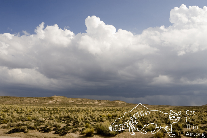
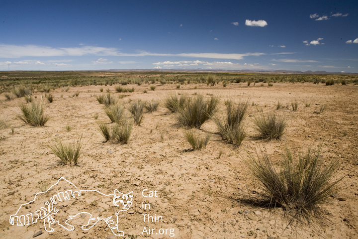
Though beautiful, we had to move on as the Andean Cats are not primarily found in these grass communities. The soil became harder and the grasses less frequent.

Altiplano, western Bolivia

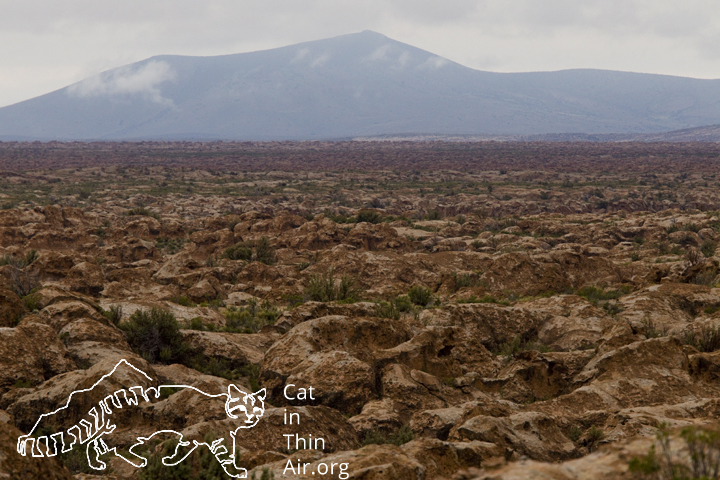
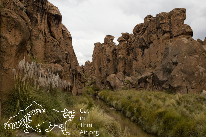
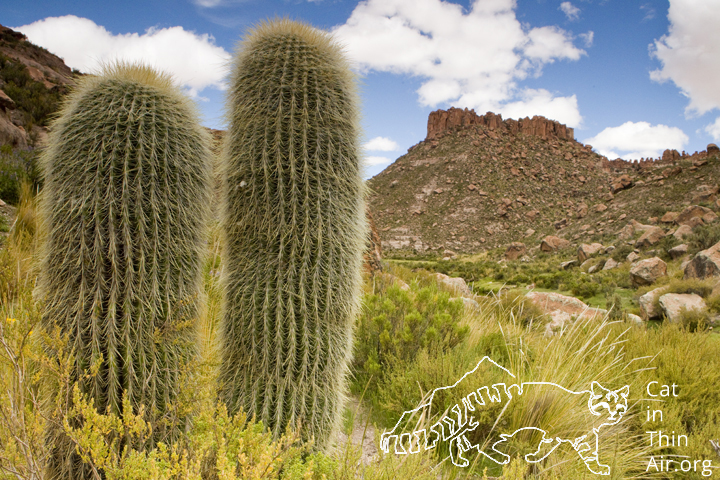
Still, we moved on. We then took a turn off the main dirt road to slowly crawl up this beautiful river valley. We were now in Andean Cat habitat. The cat prefers steep rocky areas in which its favorite prey, the Southern Viscacha (Lagidium viscacia) — future blog post to come — lives. After settling into camp life, we took a stroll up along the river. With every step, the beauty of the place became more apparent.

River flowing through valley in altiplano, Ciudad de Piedra, western Bolivia

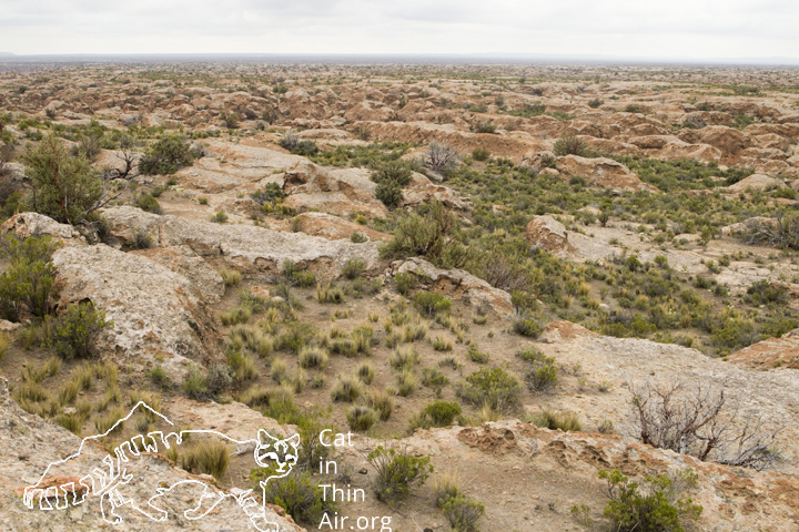
In the afternoon, we decided to scale one of the cliffs to get a better vantage point. Reaching the top was difficult work as every step is challenging, oxygen is sparse at this altitude (aka the air is thin!). Once we did though, we were once again reminded why its called a plain. This labyrinth of rocks was lying in front of us, seemingly creating this endless plateau. It was a sight to behold.

Altiplano, Ciudad de Piedra, western Bolivia

The reality of course is that this plain is continuously dissected by different sized canyons and making one’s way through them is no easy task, especially when the entrance and exit to the canyons are hard to find. The views in them though, are especially stunning.

Grasses in canyon in Altiplano, Ciudad de Piedra, western Bolivia
Cacti in canyon in the Altiplano, Ciudad de Piedra, western Bolivia

This is no easy place to live, and in some way the Andean Cat has probably been able to hold on because not many people choose to settle in this harsh environment. I felt incredibly privileged to share its space, even with all its challenges.

Preparing to Photograph a Cat at High Altitude

You have get up to elevation to get used to it!

As is probably obvious by its name, the Andean Mountain Cat lives at altitude. That however, would be putting it mildly as it’s generally found above 4,000 meters (13,123 feet). At that extreme altitude, there is substantially less oxygen, which means when you try to do anything physical, it becomes a real challenge. One way around that is to acclimatize to the altitude, which generally means spending some days at ever increasing elevations. The problem I am facing is that even my starting point of La Paz, which is the capital city of Bolivia, lies at 3,640 meters (11,942 feet). Coming from sea level in California to that elevation would be no joke. So, to get ready for this project, I wanted to get to high elevations locally to build up my red blood cell count here, which would help me at least a little for the lack of oxygen even in La Paz.

Good thing I live in a state where I can get to the Sierras within just a few hours. Enter hiking buddy and friend Marshall Moore and off we went to climb Kaiser Peak in the Kaiser Wilderness Area to get to 3,145 meters (10, 320 feet) in elevation. Getting up there was a slog, at least for me, but the views on top where quite worth it!

Sunset over Kaiser Wilderness Area, Califronia
Sunset over Kaiser Wilderness Area, seen from Kaiser Peak, California
Sierra mountain ranges at sunset, seen from Kaiser Peak, Kaiser Wilderness Area, California

Spending the night at that altitude should also help with getting used to the elevation. The higher red blood cell count should be good for 10-14 days, so with the Bolivia trip being in two days, the training should help with the altitude in Bolivia. At least I hope!